Peatland aquifer zone modeling via Wenner and Schlumberger configuration geoelectric strategies in Tarai Bangun Village, Riau Province, Indonesia
DOI:
https://doi.org/10.59190/stc.v4i2.260Keywords:
Aquifer, Geoelectric, Peatland, Schlumberger, WennerAbstract
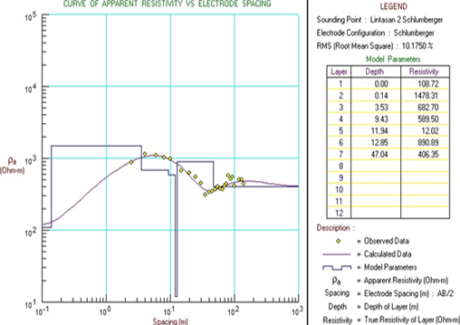
The quality of freshwater in peatland areas poses significant concerns for both governmental bodies and local communities. Challenges arise during well drilling activities, where individuals often encounter difficulties in accessing fresh water, either due to its absence or contamination with peat-infused water. Tarai Bangun Village, situated in the Kampar Regency of Riau, represents a critical peatland region warranting thorough investigation, particularly along street of Sarana Utama. Despite lacking social amenities such as markets, the area is equipped with essential facilities like schools and places of worship. This study aims to assess the efficacy of Wenner and Schlumberger configuration modeling in horizontal and vertical soil mapping, thereby facilitating a comprehensive understanding of groundwater distribution and aquifer zoning within the peatland areas under examination. Analysis conducted utilizing Res2DInv software for horizontal modeling revealed significant findings. In track 1, groundwater layers were identified at depths of 6.50 meters and 19 meters, comprising gravel, sandstone, and limestone. Track 2 exhibited an aquifer layer spanning depths from 2.50 meters to 24.9 meters, consisting of alluvium, gravel, and limestone. Furthermore, interpretation of 1D geoelectric vertical model cross-sections using Progress software unveiled additional insights. Path 1 delineated depths of 0.12 meters, 19.30 meters, and beyond 41.28 meters, featuring a lithological composition of sandstone, limestone, and dry gravel. Path 2 showcased depths of 0.14 meters, 9.43 meters, and exceeding 12.02 meters, characterized by dry sand and gravel formations.

Downloads
Published
How to Cite
Issue
Section
License
Copyright (c) 2024 Tumbur Marudut Tua Sitinjak, Juandi Muhammad, Rahmi Dewi

This work is licensed under a Creative Commons Attribution 4.0 International License.


